Key Points:
- Earning fast USACE approval is a timeline advantage
- Direct experience working in sensitive, local subgrades boosts confidence
- Customizing a support platform for unusual conditions tightens efficiencies
The Kansas and Missouri Rivers are powerful forces of nature that pose unusual risks and management responsibilities when you’re preparing to build. If you’re planning construction anywhere near these rivers, choosing the right Geotechnical Engineering partner offers significant advantages.
Permission is Your First Priority
Land running along the Kansas and Missouri Rivers falls directly within the domain of the Army Corps of Engineers (USACE). USACE engineers have spent decades carefully managing the flow of water to keep river traffic moving, and designing flood protection to keep thousands of homes and businesses safe from disaster. You simply cannot disturb the land without first securing USACE permission. A Geotech partner with a long history of working with the USACE will know the process well and help you nail down permission to build.
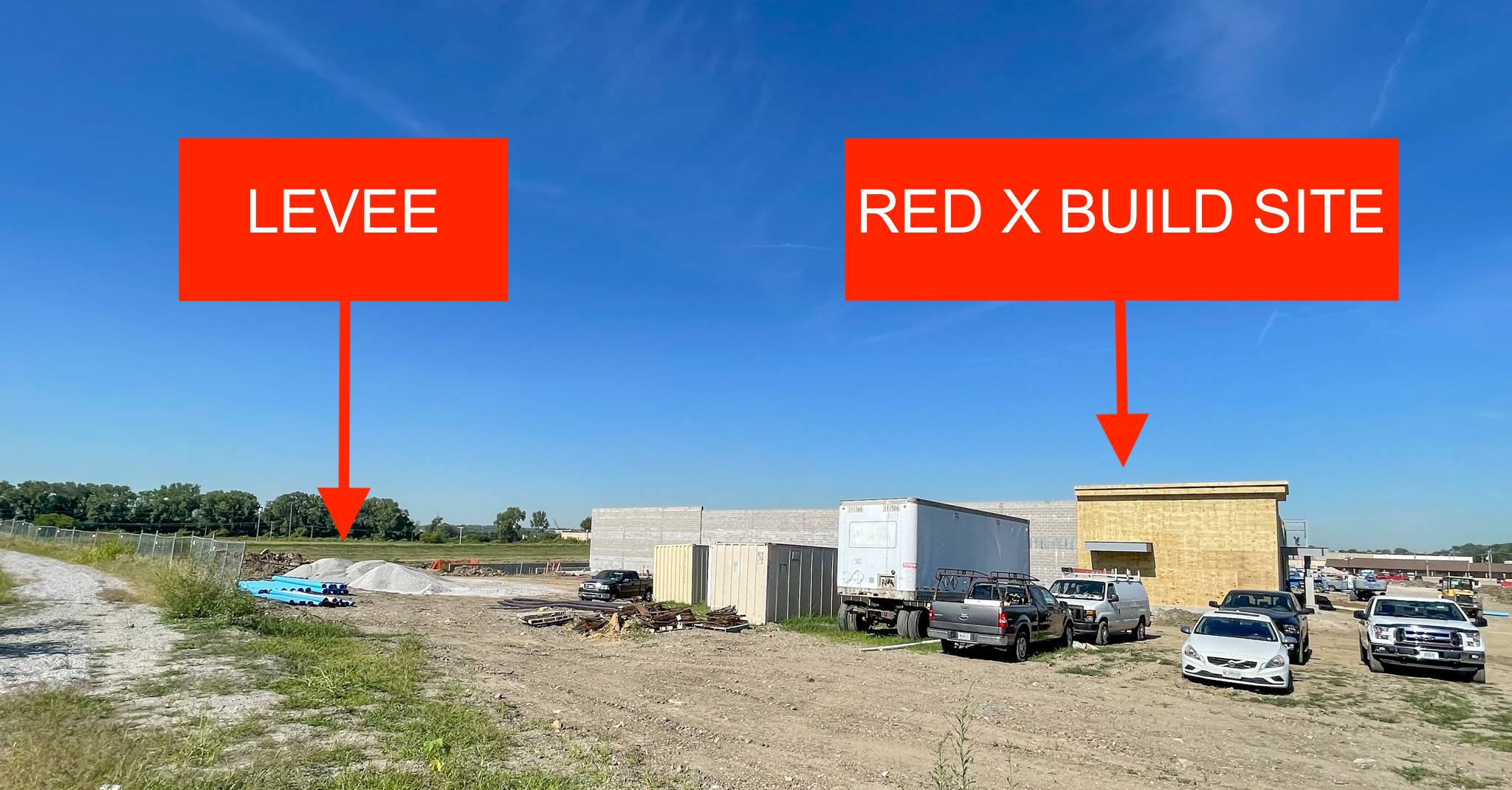
If your build site is near either river, it will probably be near a levee, too. That means you’ll also need permission from the local levee district before you get to work at the site. Levee districts share the responsibility of maintaining the structural integrity of the levee system, including any development impacting the levee itself and ‘levee controlled’ land surrounding it. Levee controlled land can extend hundreds of feet from the levee centerline. If your project falls within that range, there’s no getting around securing levee district permission.
Partnering with a Geotech firm that understands how to clear the way for construction near rivers will streamline your plans and get your project moving without delay. A firm with a long history of engaging the USACE and local levee districts will quickly assess the general parameters of your project and facilitate compliance conversations with the right people.

Alpha-Omega Geotech helped to quickly secure permission to build the new Riverside Red X just yards from the Riverside Quindaro Bend Levee.
Experience in Sensitive Subgrades is Key
As a river community, the Kansas City area takes flood protection very seriously. A complicated system of pumping stations, levees, and flood walls stretches over 60 miles to effectively control the river. The USACE has precisely planned and constructed every inch. And now, a new half-billion dollar effort is underway to make even more improvements aimed at making the system more resilient to climate change.
Commercial construction in levee controlled areas requires a sharp awareness of the interconnectedness and what’s at stake before you dig in. A Geotech partner who knows firsthand how easily the complex balance of flood control system components can be disrupted, will offer realistic judgment and take no chances. They’ll conduct an investigation and make recommendations with particular sensitivity to avoiding risks of underseepage, instability, and other problems the USACE is focused on preventing.
Depending on the exact location of your build site, the right Geotech partner may also draw on their local experience to ensure critical slope stability and control potential buoyancy forces. An academic understanding of such situations is one thing, but direct experience handling them in Kansas City area subgrades is another. Hands-on experience is always preferred.

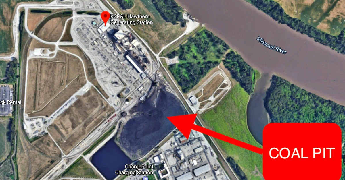
Alpha-Omega Geotech recommended foundation slab adjustments beneath the coal pit at Evergy’s Hawthorn Generation Station to counter upward buoyancy forces from the nearby river.
A Track Record in Unusual or Unknown Material is a Bonus
The USACE uses a variety of strategies to build up the levee system and reinforce it to withstand the threat of floodwater breaking through, or finding its way underneath. USACE engineers often take steps to strengthen land next to the levee to help fortify the levee itself and keep water from carving upward paths far below the surface.
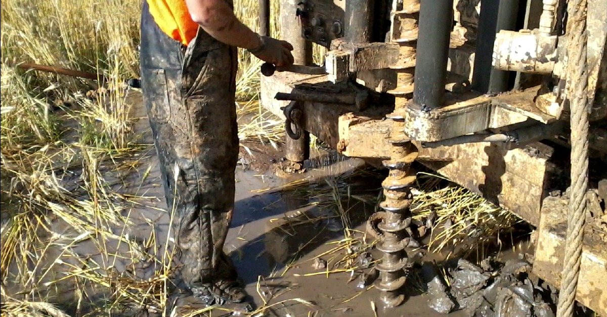
Sand and clay are common layers constructed deep down to form barriers for preventing water from flowing beneath a levee and up the other side. Your Geotech partner will want to drill into these layers to analyze their condition, but the bigger challenge may be the material on top of those layers, all the way up to the surface. Rocky, uncontrolled fill material is often used by the USACE to provide the strength that levee controlled areas need. The fill can include sand, rock, and even broken up concrete hauled in from unrelated projects.
The cost of exporting all uncontrolled fill material and replacing it is not likely to be realistic. Extensive drilling through the material can be difficult and expensive too, as drills hit large chunks during deep foundation development or even mid-level ground improvement enhancements.
Your Geotech partner should be able to offer ideas for alternative support platforms that limit the scope of drilling while still ensuring performance in context of the conditions. For example, a shallow platform consisting of engineered controlled crushed rock wrapped in geogrid may be possible. Such platforms, closer to the surface, can effectively absorb and spread out distribution of the weight load with no need for drilling deeper.

An experienced partner can recommend other options to limit expensive and difficult drilling.
Smart Geotechnical solutions in river areas are time and budget savers, but only in the hands of engineers who know Kansas City soils and how to prepare even the most complicated subgrades for getting construction projects out of the ground. Choose a Geotech partner wisely and you’ll see their local experience and expertise pay off in a build site put together with confidence, and a project plan executed with fewer complications.
Planning a project? Contact us about Geotechnical Engineering Services and Required Special Inspections >>

